
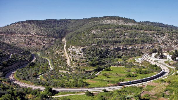
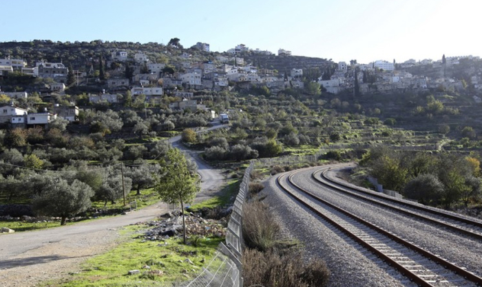
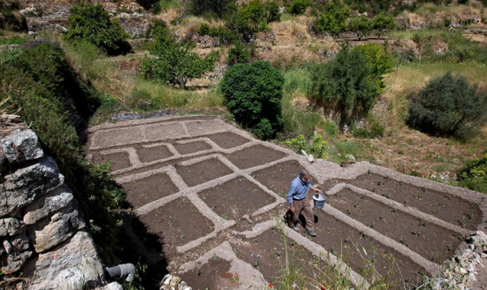
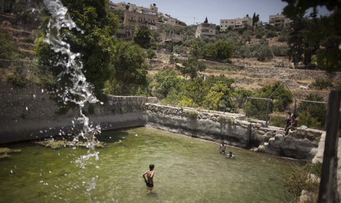
Built thousands of years ago around a natural spring in a precipitous valley in the Judean hills, Battir remains one of Palestine’s most beautiful villages. Houses stand on man-made rock terraces, lined with the olive groves. The village’s flourishing agricultural trade has been maintained, since the ottoman era, by connection to markets through the railway which runs through it, and, since the Romans, a system of sluice gates. This ancient irrigation system has provided fresh water to the village through its seven springs for over 2,000 years.
One of the few locations where such traditional methods of agriculture are still in use, the ancient village looks much as it has done for hundreds of years. Taking a look beneath the peaceful, ancient rural scenery of the village, however, reveals a diverse history.
Today, many Palestinians pause at the railroad and remember 1948, when the village found itself at the front line of fighting. They pose for photos on the railway tracks which once marked the Green Line that first demarcated the boundary between the West Bank and Israeli Territory in 1949.
Though the Green Line was intended to have no administrative or legal significance, in practice, the demarcation line had extensive implications for those living on both sides of the boundary. Many of those who returned to the village after fleeing the 1948 War found their position there transformed from land owning citizens into mere residents, permitted access to their land – which now lay in Israeli territory – in exchange for the railroad remaining un-damaged.
After the 1948, efforts to maintain life in the village were frustrated again when the 1967 Six-Day War resulted in another mass exodus, and full Israeli control of the area. After a period of recovery, in 1995, the Interim Agreement did little to stem conflict over the area and efforts to divide the land further, were continuous.
However, in 2007, when the village’s historical agricultural system took on a, surprising, political colouring, something of an olive branch for the future of this heavily contested village. On account of the historical import of the ancient irrigation system, the planned route of the Israeli-West Bank fence, which was to cut through it, was amended to take account of this newly designated Israeli heritage site.
Although the village continues to struggle against settlement expansion, today, the area is not only a flourishing agricultural village but a popular tourist attraction, with friendly, knowledgeable local guides available for hikers wanting to explore the area, and get to know its history. Accessible by minibus or taxi only 7km from Bethlehem, or nearby Jerusalem, the area provides a great and easily accessible opportunity to discover Palestine. A hike through the steep hills, through the picturesque gardens to the Ottoman era tombs of Battir provides a glimpses of the diversity of what Palestine has to offer, from stunning countryside to insights into a complex and ancient history.
How do I Obtain More Information?
Please email us at info@gopalestine.ps or info@gopalestine.org. In the email body, feel free to ask any questions you have. We will respond to you promptly.
Chat With Us!
WhatsApp or Signal: +972-598172071
Volunteer in the West Bank - Go Palestine in Hebron offers a special opportunity to support Palestinian communities while experiencing their vibrant culture, profound history, and daily life under occupation.
To Check All our Volunteer & Internships Programs, please visit this link:
https://gopalestine.ps/volunteer-and-internships-programs-in-palestine/
Apply & Fees:
https://gopalestine.ps/how-to-apply//
Follow Us on Social Media:
Instagram: @go_palestine
Facebook: Go Palestine Hebron
YouTube: Go Palestine Channel
